european atlas
European atlas of Water Source: the exploitation of mountain rivers through hydropower networks, expected climate change effects and the conflict of different national policies applied to one single landscape entity.
Mountain rivers constitute the core of European water resource. In the last century, in order to exploit that, many human interventions transformed these territories. Among them the hydropower generation has become one of the most controversial and crucial asset in the Energy Policy agenda of the European Union.
The Pan-European Atlas of water source emphasizes two critical features that need to be taken in account in this proceeding. On one hand the future climate change represent a remarkable challenge whose effects will radically turn the entire hydropower notion and enforcement, while on the other the role of national boundaries radically limits a common European engagement.
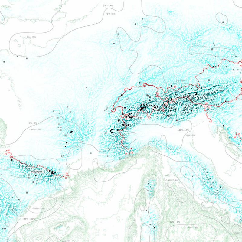
More than others the Alpine territory clearly states a conflictual condition in which seven different national policies read and handle a single system.
From a more local perspective the water management deals also with complex specific conditions. The primary security requirement against flooding hazards, the conservation of the traditional economical and social organizations within a infrastructural urbanization tendency, with the related consistent shifts in the amount of population, and the claims of mass tourism as the dominant economy portray the fascinating complexity of mountain territories. Furthermore these conflicts are inscribed in a framework whereas aesthetic categories of sublime and picturesque on one hand and tecno-infrastructural efficiency on the other enhance opposite approaches to the territory.
The intent of the project is to provide a model through which the mentioned changes both in geomorphological and social processes could be faced. The establishment of a flexible and temporary management of land uses and ownerships is the main effect produced by a river landform capable, as sediments machine, to engage the dynamical variation within seasonal and long term time frames. Moreover the project proposes a serie of small punctual interventions whose substantial consequences along the river don’t rely on a mere ecological value restoration but widely involve the various human activities, from agricultural and industrial production to tourism processes.
In fact many initiatives and projects on mountain river restorations in the European context have already been experimented, although their purposes is limited just to the implementation of the ecological resource by the current rigid structure and concept about land expropriation and fixed uses. Accordingly the local populations in terms of residents, farmers and corporations are not encouraged to give up their lands and contribute to a diverse territorial configuration through which achieve social, economical and environmental benefits. From this point of view the on going Ahr river restoration project in South Tyrol (Italy) represents an emblematic case study.
Therefore from a landscape urbanism perspective the project advances possible guidelines which from the valley scale to the Alpine one engage the ordinary layout in order to deal with the consistent challenges mountain territories are passively suffering.

European atlas of Water Source: the exploitation of mountain rivers through hydropower networks, expected climate change effects and the conflict of different national policies applied to one single landscape entity.

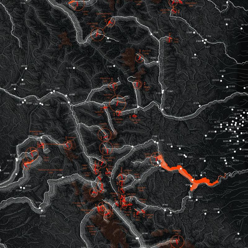
Territorial formations in the Alps: the social and economical relations between settlements, mountain rivers and hydropower networks.
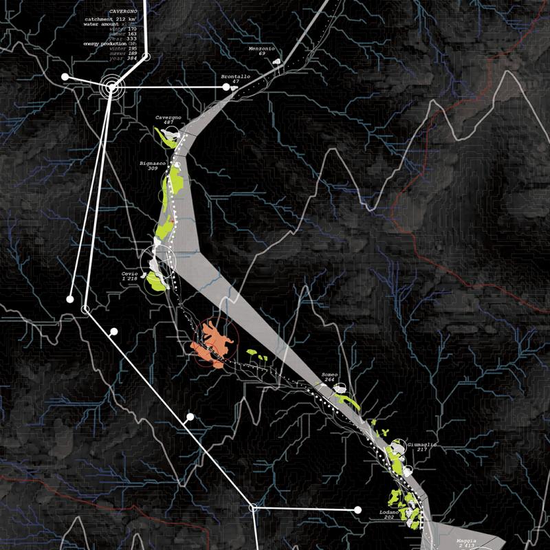
Territorial formations in the Maggia Valley: effect of the hydropower network on the riparian landscape and it's social and economical connections with settlements and human activities.
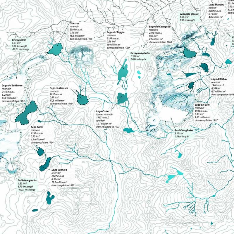
Geomorphological processes_Maggia Valley: the hydrologic network of the Maggia Valley, from the glaciers to Lago Maggiore. Different factors like precipitation patterns and climate change affect this network on short and longer timescale.
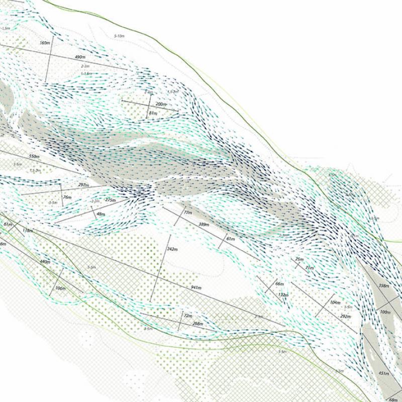
Geomorphological processes_detail: detail of the Maggia river showing the behavior of water and sediment flow and the factors which affect this behavior like flow depth, flow velocity and vegetation types.
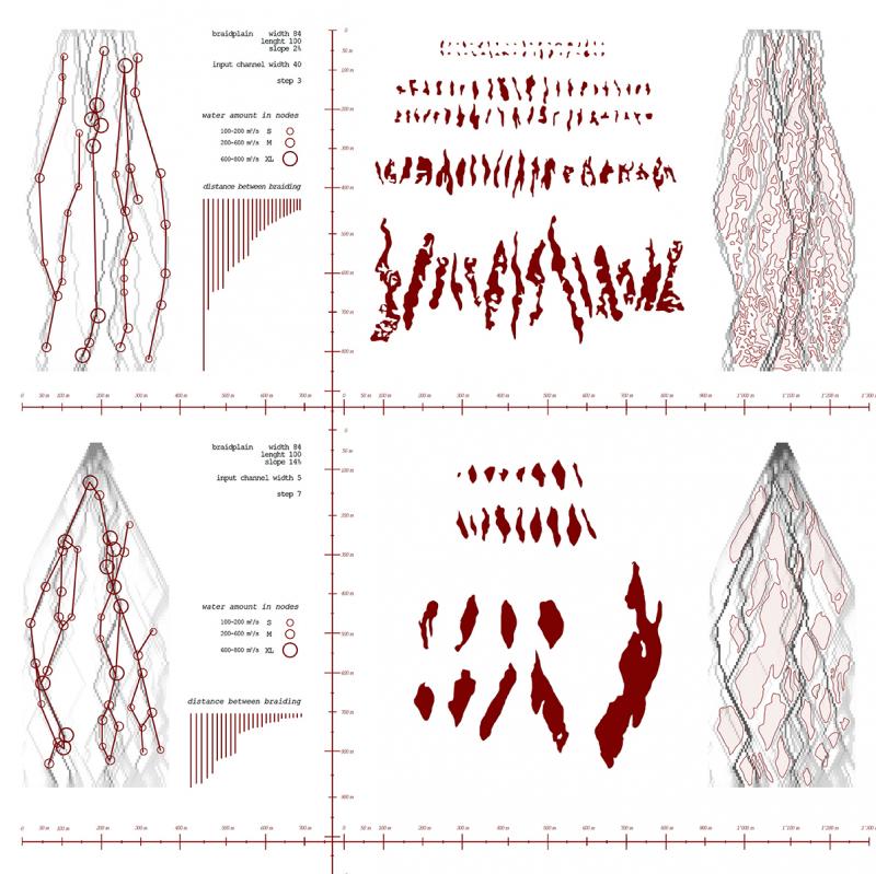
Landform simulations: software simulations of a braided river system, tested with different water and sediment inputs to research different possible scenarios.
Cartogenesis: a design strategy based on the geomorphological and territorial conditions. Water and sediment flow, run off, slope and vegetation composition determine possible land and water formations. Three different categories are applied to the various activities along the river to identify the degree of possible integration in the riparian landscape.
Diagram explaining the geomorphological conditions - in terms of amounts of sediments, possibility to create pools, etc -, showing the river as a machine to generate new landscapes.
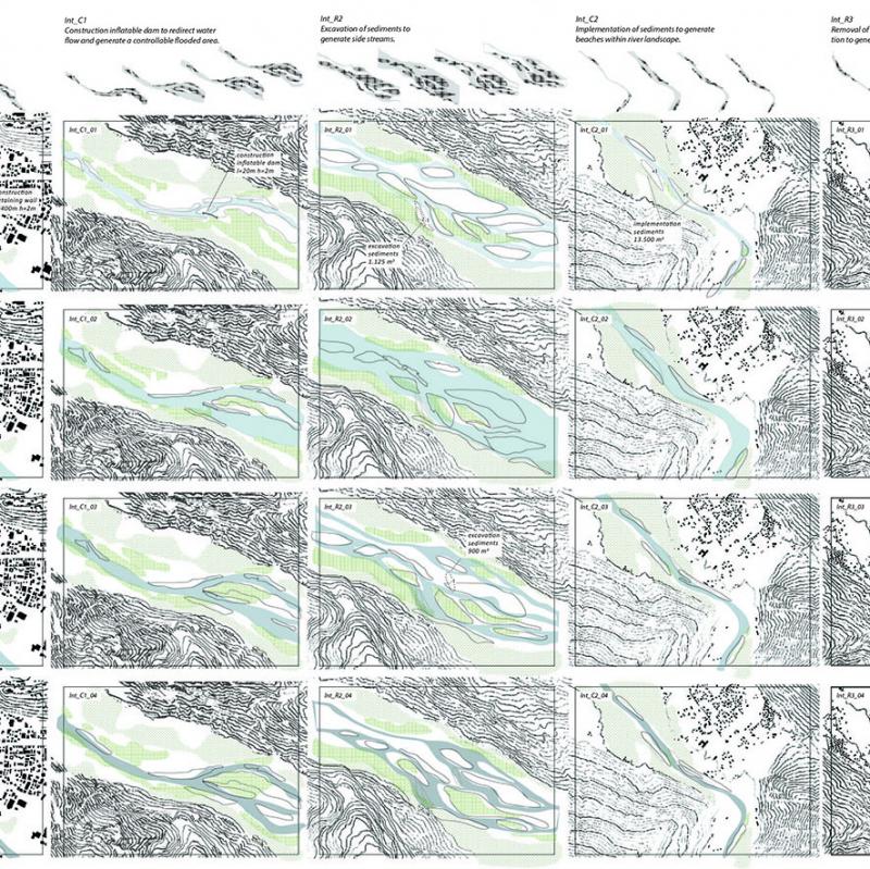
Catalogue of possible interventions: categorized in three degrees of possible integration within the riparian landscape and three different types of intervention: soft, medium, hard. To be used as guidelines together with the cartogenesis as a design strategy to apply on specific sites.
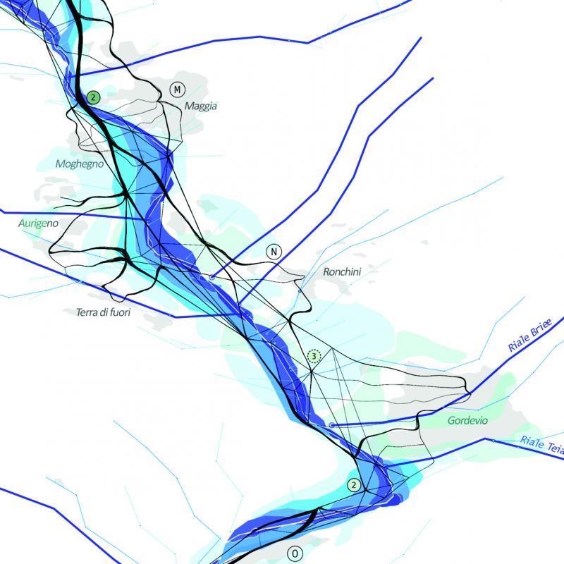
Tectonic_intersections: proposal of a sequence of local interventions over the timescale of a year, taking into account seasonal changes in precipitation patterns and large scale interventions at the dams; release of water and sediments.
The interventions aim at partially controlled transformation of the landscape, in order to integrate surrounding activities in the riparian landscape; such as aquaponic systems, leisure activities and strengthening of relations of villages with the river.
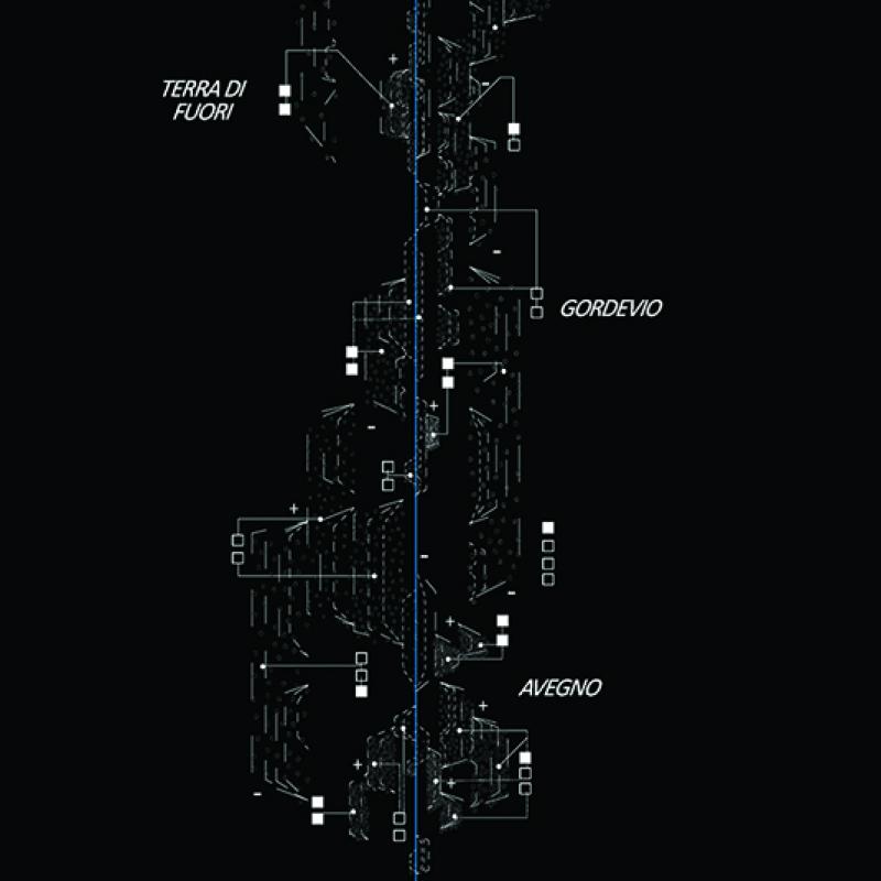
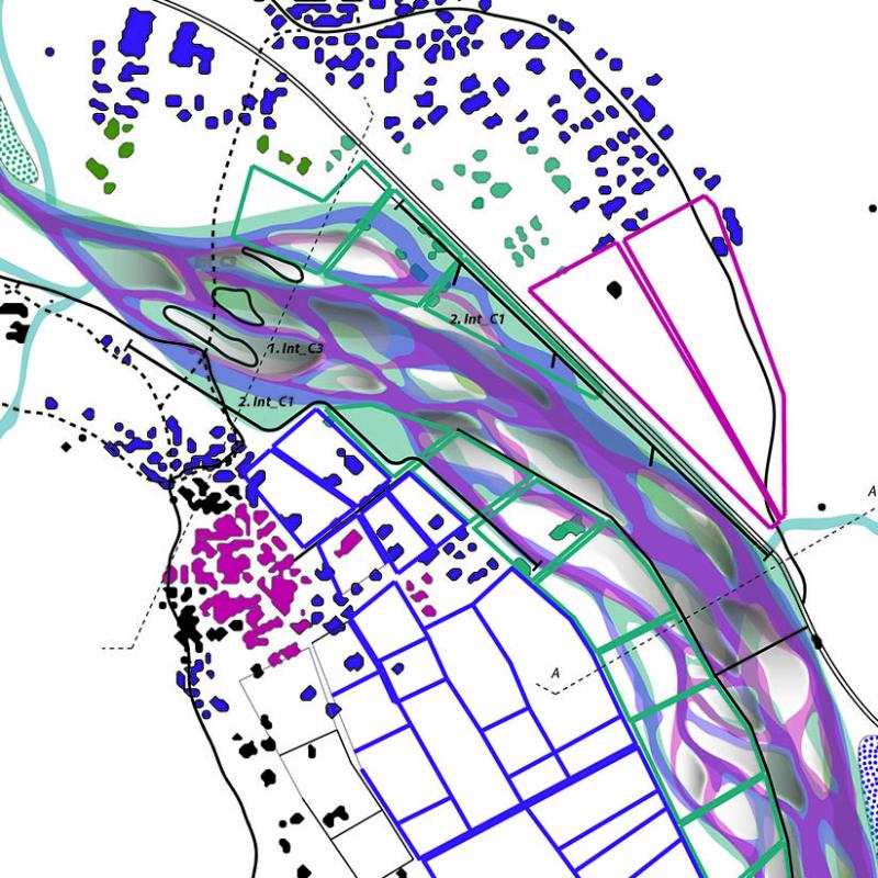
model of the intervention over a stretch of 5km river, showing in three different layers the transformation of the landscape; flooding and creation of land, generation of new (temporary) activities within riparian landscape and the non-physical social and economical effect on surrounding areas.
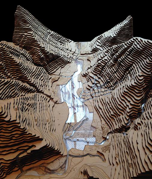
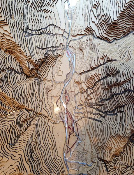
model