AA Landscape Urbanism 13-14 ATLAS_I
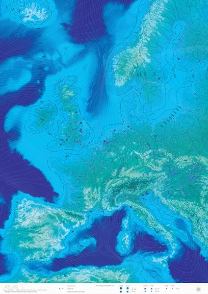
As the land crust is subsiding and under the low air pressure, strong surges tend to form in the shallow channel and affecting coast in Uk, Netherlands, and etc.
Valeria GARCIA and Yunya TANG
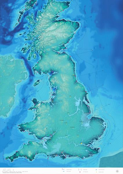
The British territorial crust is subsiding and global warming makes the southern England in siege. Facing to this invasive flooding, the short-term flooding protection tends to act upon a centralized territorial framework.Furthermore,a restrictive insurance policies tend to immobilize the territorial profitability.
We do believe a different attitude brings a different scenario. Instead of passive hard engineering and driving people out of their land, we choose to co-exist with flooding physically and economically.
We proposes to revert the broken economical model with using tidal force as instrument for transformation.Here flooding act as an agent to influence the regional disparities, and potentiate decentralization.

As the land crust is subsiding and under the low air pressure, strong surges tend to form in the shallow channel and affecting coast in Uk, Netherlands, and etc.

South of England especially cities located at estuary has suffered more and more from the surge in recent years. Flooding has become a territorial problem in UK.
Last winter, the southern England was widely invaded by flooding. This mobilize coastal communities, That urges people to seriously consider this issue.
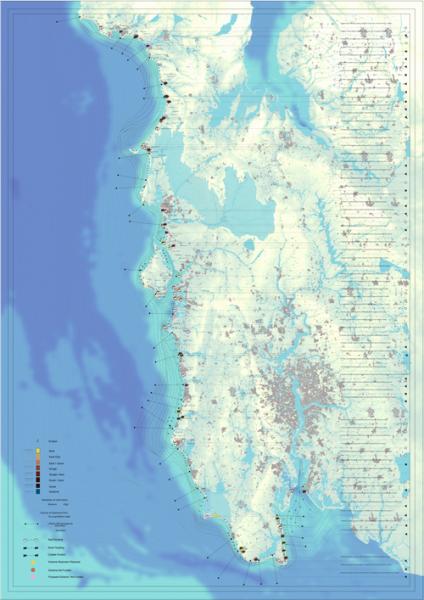
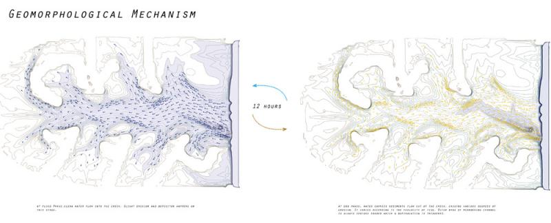
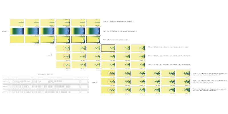
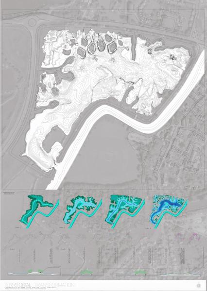
During our field trip, we found tidal forces are dominant elements for the land formation in this area. It excavates the earth, and create an erosion and leave behind special landscape.
Tidal force bring clean water to land and cause erosion at ebb phase. That's the simple mechanism which form the tidal creek system.
In order to understand the geomophorlogical process with tidal force and formation of tidal creek, we have a series of studies. By exposing the site to tidal conditions, we noticed that, the water distribute unevenly because of the complex topography.
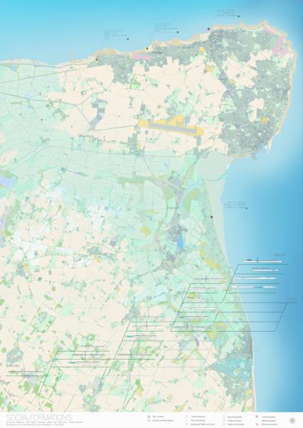
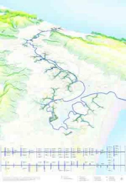
Agriculture, industry, horticulture, natural reserve are the main land use in this area.
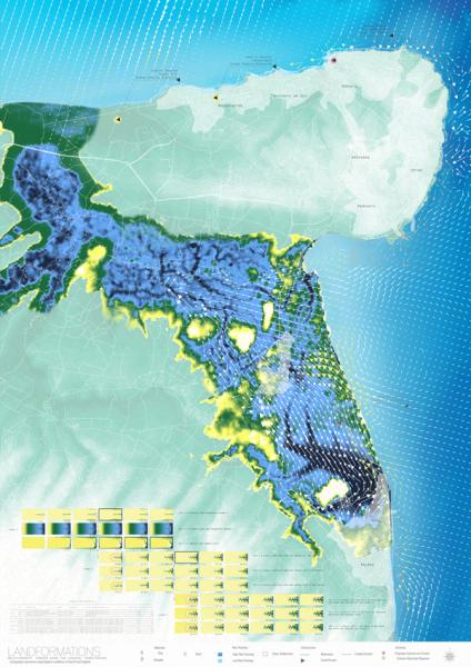
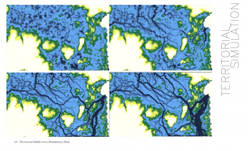
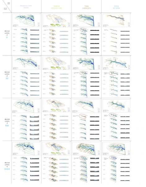
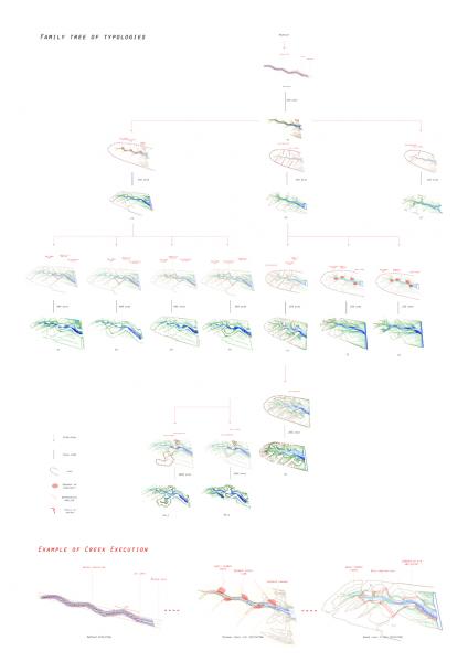
Considering the current land use and the water amount we have developed 4 models for land formation in the territory. Natural creek, town landscape, hybrid agriculture and aquaculture.
With different interventions at specific stage, the landform react differently. For example, we have to go through the natural creek 1, by giving vegetated island, we can have town landscape 2, and again , by constructing the close dyke system, we finally get the aquaculture 3.
Dyke and dredging are the main approach of the intervention. Dyke can help concentrate the water energy while dredging is able to redirect the water course.
The catalog informed us a way to control the land formation. Our execution will make a large use of the drainage system on site. By a series of executions- will provoke or block them, and produce the creation of a series of local actors that enable the introduction of new activities such as hybrid agriculture, aquaculture, and recreational landscapes.
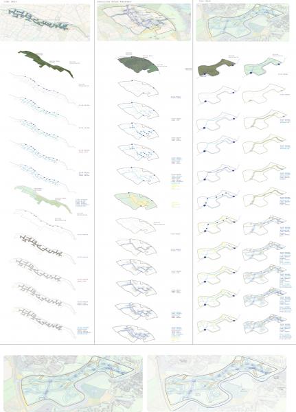
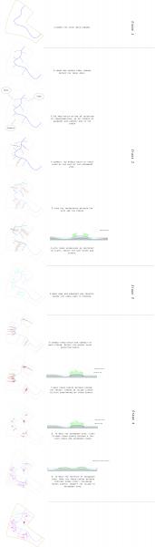
typology application on site
1)
We have decided to develop with higher resolution the near the town
The site will be adjacent to campus of Kent University, the town urban fabric and a industrial state .
2)
Using a tidal force as instrument for transformation, A series of executions employ dykes and soft island as infrastructure for inhabitation and to also provoke the landscape further over a period of 50 years.