Mt. Thames
Mt. Thames project envisions how inhabited green infrastructure changes dense urban scape by adapting regional flood risks and housing demand of London.

Catchment based flood risk management provoke widening open water space operated by nature of tidal floodplain. Minimized ground coverage enhances the restored floodplain ecosystem. Water infrastructure expands the habitable space vertically and creates a continuous city network above ground. Majority of accessible horizontal space embedded with subsurface Water treatment system which becomes public access route. ‘Hydro core’, ‘Roof marsh corridor’ and ‘Flowing terraced streets’ facilitate community connectivity and activity as well as water infrastructural capacity.

Mt. Thames reviews the Regenerative value of land and river resource for the urban expansion by adapting flood risks. The integration of infrastructure and inhabitation attracts the community to experience a unique lifestyle in the mountains of infrastructural urban density along the River Thames.

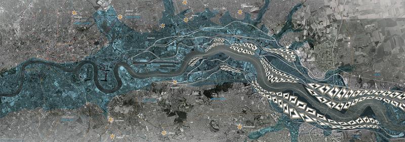
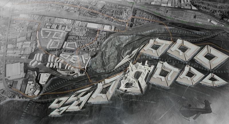
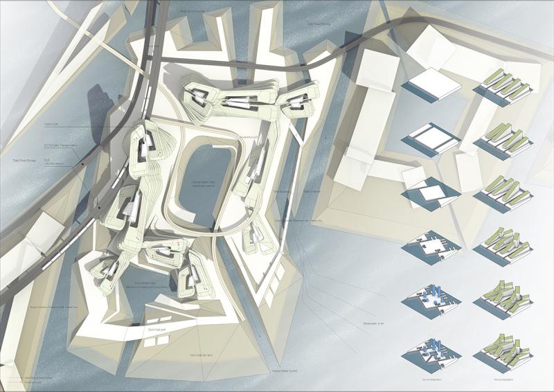
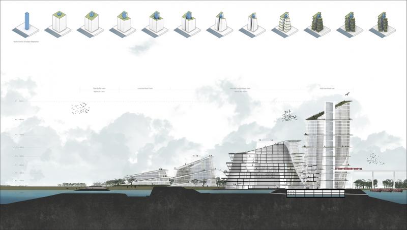
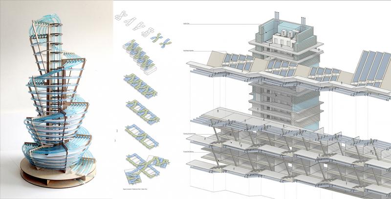
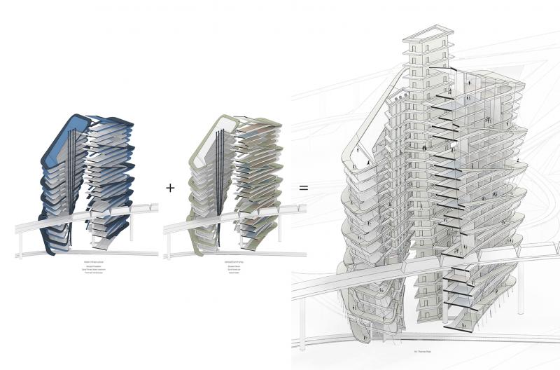
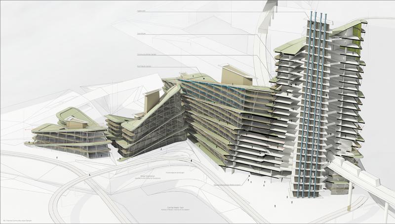
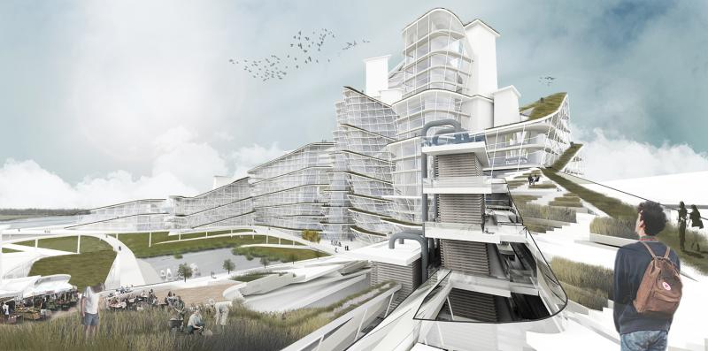
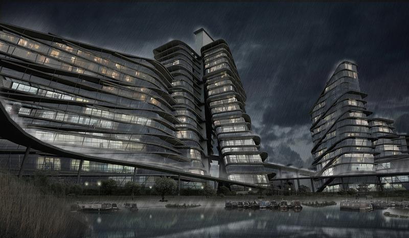
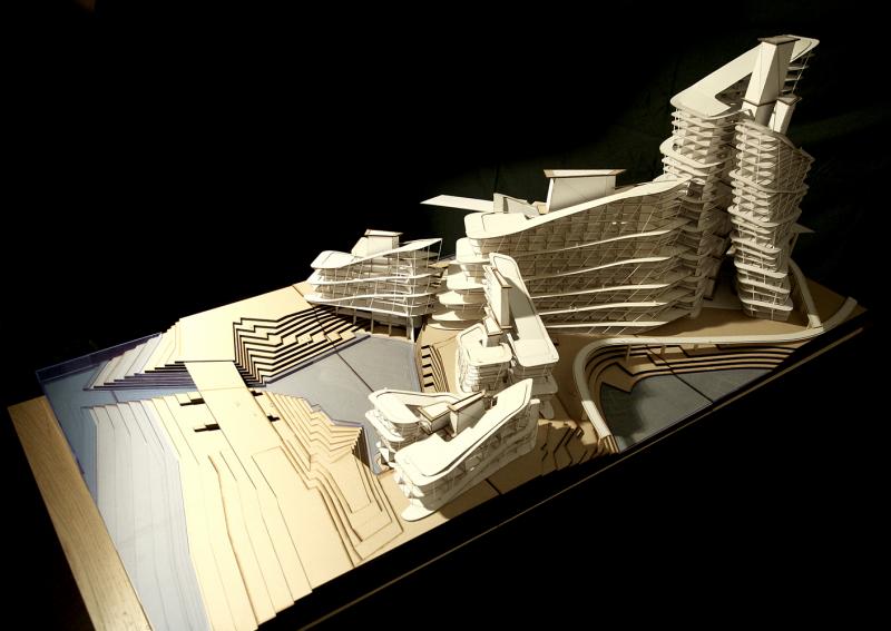
01-Mt. Thames East London

catchment and diversion scenario applied as design framework not simply protecting but managing floods as water resources. In regional scale, the city of hydro mountain present a new infrastructural mountain landscape to London.

02-site Barking Riverside

In town scale, The Mt. Thames apply more active Catchment with elevated city infra network such as DLR and ELT bus network. Freed ground performs as floodplain and brings various benefits as organic production, food, eco-services and related activity. Connected elevated network roof and terraced path enhance the accessibility to the river and fill the gap between river edge and flood boundary with urban community life.

03-site Barking Riverside

Open space used as the flood storage at the same time as the field for community activity
Land and density massing also adapt its form to create more interactive relation with river.
The idea of elevated marsh devised hydro core to bring water close to the community life.

04_Regenerative flows on Mountain section

In block scale, as infrastructural operation, Water flows in through landscape and circulated via all buildings. The mountain slope leads locals to various open closure quality of space.
Ground let tide in and operates as flood plain, Public moves through the terraced streets and public corridor on the roof.
Hydro core transports water and people to the roof and elevated new datum. Water flows down through horizontal subsurface of buildings to treats sewer and tides.

05-water system diagram

On the building scale, water flow embrace overall building structure and envelope so filtrate capacity can be increased also internal habitable space achieve thermal homeostasis by perpetual water circulation.

In structural wise, hydro core ties horizontal floors back by trussed bracing. Spiral terrace distributes water and take sewer from sub wet balconies to combine sewer treatment.

06-environmental assessment

the diagram shows how water infrastrucutre accommodates inhabitant's social mixture. Hybridization of infrastructure and mixed community operates through vertical movement of hydrocore and spiral terraced streets. various program and community voids along the spiral path facilitate natural operation of the system.

07-urban sample

The continuous path along water flow blur the boundary between nature and city also, blending the private and public which make strong sense of belonging. On the spiral terraced street public becomes private and vice versa. This seamless network secure the level of public safety and promote community culture.

Mt. Thames in dry season

In summer, It becomes time for a celebrating for the rich nature and enjoying the mountain of dense urban scape along the river front.

Mt Thames in wet season

In winter, Heavy rain and high tides will make community life more active in protected inner atrium and community space without impacts from the flood.

Mt Thames physical model scale 1:200

Mt. Thames shows inhabited Green Infrastructure plays a key catalyzer forming the urban density scape on the future Thames riverside.