European Atlas: Shrinking cities & Floodplains
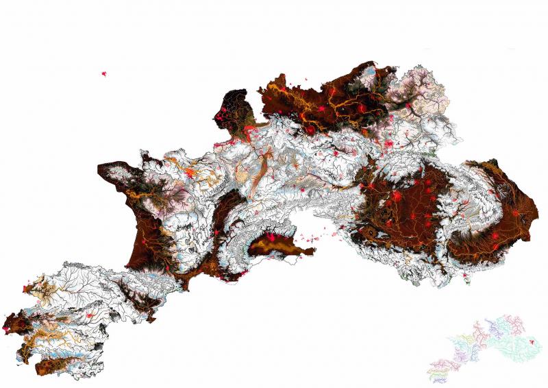
This European atlas depicts cities in the floodplains of Europe. The focus lies in the Central and Eastern Europe and the post-socialist cities that are experiencing shrinkage.

This European atlas depicts cities in the floodplains of Europe. The focus lies in the Central and Eastern Europe and the post-socialist cities that are experiencing shrinkage.

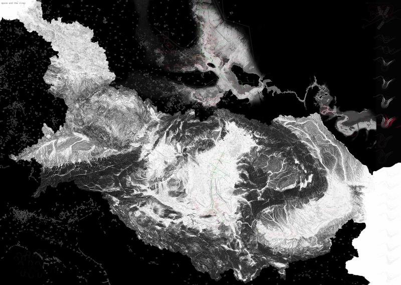
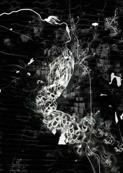
The rivers Elbe and Danube are studied for its meander formation stages across time. A study is conducted using ArcGIS software to overlay the location of sediment and vegetation. This helps determine the river movement (lateral and transverse) across time and to understand how features like oxbow lakes are formed.
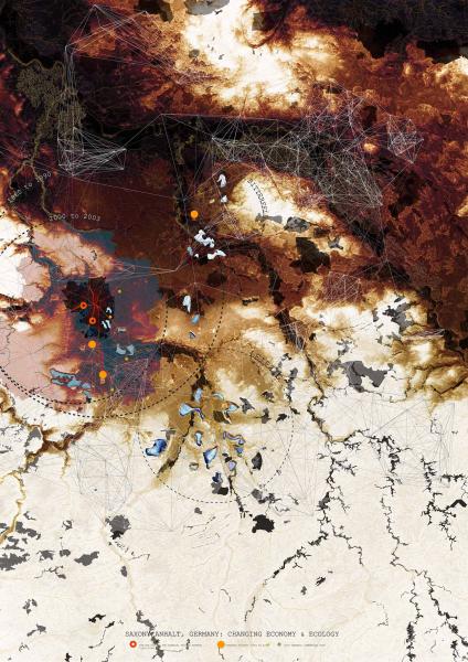
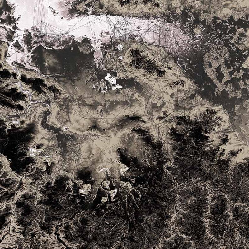
Region of Saxony Anhalt, Germany is also referred to as the "chemical triangle". Between 1960 to 1990, this triangle formed of the cities of Halle, Bitterfeld and Leipzig was famous for its chemical factories with its landscape of open cast mines and polluted rivers.
The map describes the change it faced in the post-socialist era, in terms of economy. Due to de-industrialisation as well as suburbanisation, there has been a massive depopulation or shrinkage. An attempt to revitalise a service sector for education, tourism etc. is underway.
The overall landscape of ecology and tourism is being advocated, with the open mines being converted to lakes and restoration of the river floodplains.
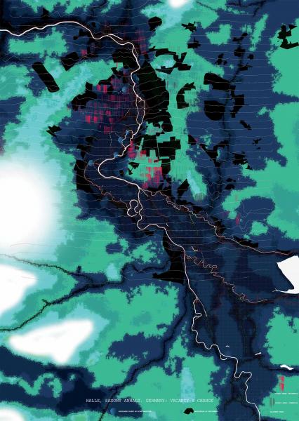
The shrinkage of the city of Halle is studied. The main areas include two types: pre-fab housing sectors and industrial plots.
The housing which earlier housed chemical factory workers and professional lie majorly vacant as the preference for detached housing. Under the state policy of demolition of vacant housing, these areas are being demolished and converted to nature as urban forests.
These areas mostly lie in the floodplain of the river and become the project site for flooding and creation of landform that can be put to use of inundation, water storage and agriculture.
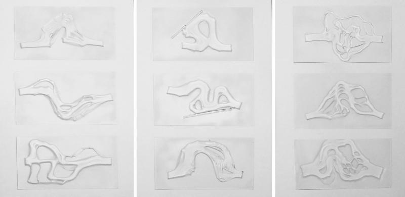
Based on the model studies of the river form, three model forms are chosen to effect change in the floodplain to make them more capable of storing water during extreme flooding; to maintain certain infrastructure zones free of flooding and to convert the vacant areas in the state owned land into productive agriculture and inundation zones.